acquired March 17, 2013
download large image (8 MB, JPEG, 5600x7200)
acquired March 17, 2013
download GeoTIFF file (61 MB, TIFF)
acquired March 17, 2013
download Google Earth file (KMZ)
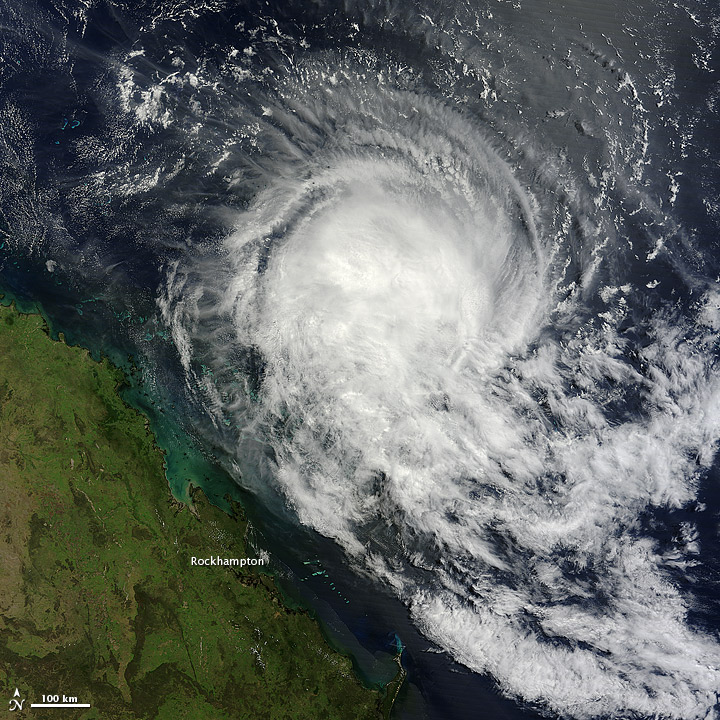
Tropical Storm Tim formed over the
Coral Sea on March 13, 2013, and remained off the coast of northeastern
Australia for the next four days. The Moderate Resolution Imaging Spectroradiometer (MODIS) on NASA’s Terra
satellite captured this natural-color image of Tim on March 17.
Although lacking a distinct eye, Tim still had the spiral shape
characteristic of strong storms.
Unisys Weather reported that Tim’s wind speeds rose to 55 knots (100 kilometers per hour) on March 14, but by March 17, speeds had dropped to 35 knots (65 kilometers per hour).
Another image of Tim, acquired on March 14, is available from the LANCE MODIS Rapid Response site.
Unisys Weather reported that Tim’s wind speeds rose to 55 knots (100 kilometers per hour) on March 14, but by March 17, speeds had dropped to 35 knots (65 kilometers per hour).
Another image of Tim, acquired on March 14, is available from the LANCE MODIS Rapid Response site.
References
- Unisys Weather (2013, March 18) Tim Tracking Information. Accessed March 18, 2013.
NASA image courtesy Jeff Schmaltz, LANCE MODIS Rapid Response. Caption by Michon Scott.
- Instrument:
- Terra - MODIS
- NASA: It is happening now - Está sucediendo ahora - 19-03-13 - Tropical Storm Tim - Coral Sea zone - Australia

No hay comentarios:
Publicar un comentario