Storms get all sorts of names.
Weather forecasters use terms like snowstorms, hailstorms, blizzards,
low-pressure systems, hurricanes, derechos, and twisters. Individual
tropical storms have long been named
by the U.S. National Hurricane Center and the World Meteorological
Organization; more recently, media outlets have started naming winter storms.
Research meteorologists and climatologists have a simpler way of classifying storms: thunderstorms, tropical cyclones, and extra-tropical cyclones. All are atmospheric disturbances that redistribute heat and produce some combination of clouds, precipitation, and wind.
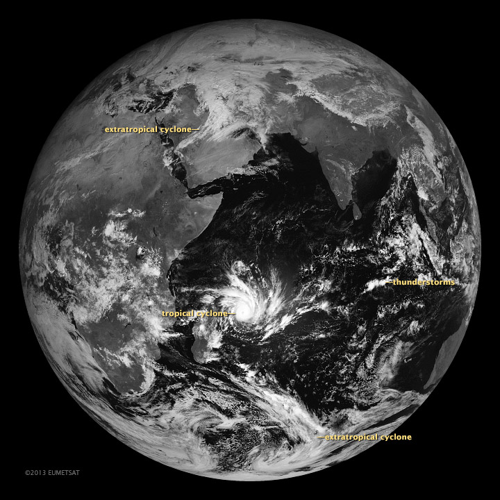
A EUMETSAT weather satellite acquired this image on January 29, 2013. It shows examples of all three types of storm. Thunderstorms are the smallest, tropical cyclones are significantly larger, and extra-tropical cyclones are the largest. In satellite imagery, the clouds of a mature extra-tropical cyclone are sprawling and comma-shaped, whereas mature tropical cyclones are spiral-shaped and often have a distinct eye at their center. Thunderstorm clouds are irregularly shaped and have towering cumulus clouds that billow upward, creating a textured appearance on the tops of clouds layers.
All three require moisture, energy, and certain wind conditions to develop, but the combination of ingredients varies depending on the type of storm and the local meteorological conditions. For example, thunderstorms form when a trigger—a cold front, converging near-surface winds, or rugged topography—destabilizes a mass of warm, humid air and causes it to rise. The air expands and cools as it ascends, increasing the humidity until the water vapor condenses into liquid droplets or ice crystals in precipitation-making clouds.
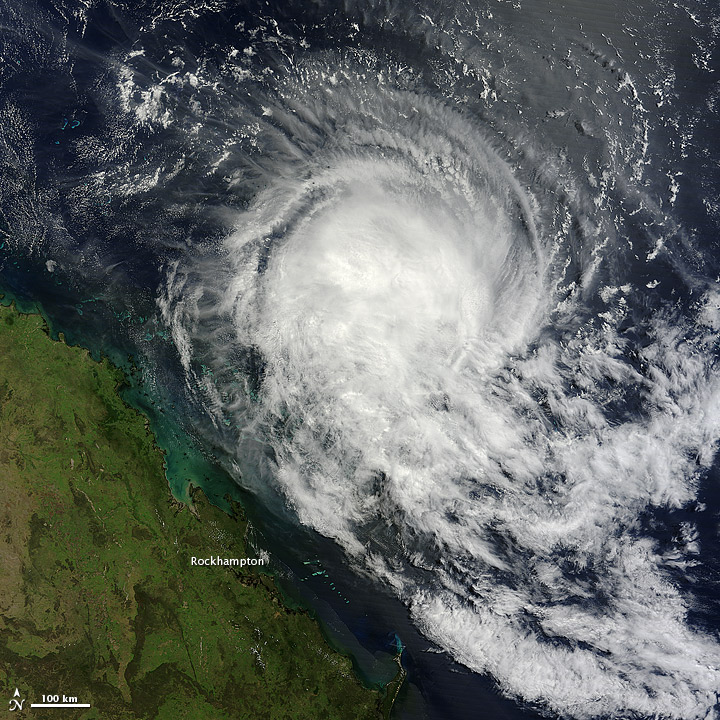
Tropical cyclones—more commonly known as hurricanes and typhoons—occur when many thunderstorms organize into a larger system and begin flowing in a circular pattern around a low-pressure center. These storms thrive on warm ocean temperatures for energy; sea surface temperatures need to be above 80°F (26.5°C) for a tropical cyclone to form. However, they cannot thrive when wind shear is strong. Wind shear occurs when surface-level and higher-level winds are blowing at different speeds or in different directions.
Extra-tropical (or mid-latitude) cyclones, which can produce weather ranging from mild rainstorms to violent blizzards, are even broader storms that typically begin in the middle or high latitudes. While tropical cyclones draw their energy from warm air masses heated by equatorial oceans, extra-tropical cyclones draw their fuel from the interactions of fronts—large horizontal air masses with different temperatures or humidity.
Read our new feature In a Warming World, Storms May Be Fewer but Stronger to see how climate change is affecting these three types of storms.
Further Reading
- NOAA. Thunderstorms. Accessed March 6, 2013.
-
- University of Illinois. Midlatitude Cyclones. Accessed March 6, 2013.
- University of Rhode Island. A Hurricane’s Energy Source: The Ocean. Accessed March 6, 2013.
NASA images and animation by Robert Simmon, using data ©2010 EUMETSAT. Caption by Adam Voiland.
- Instrument:
- Meteosat
NASA: Storms Come in Many Forms - 19.03.13


